163 MPH winds and other winter woes hit LH

January 5, 2008

Three large winter storms have combined to cause what is being called by the National Weather Service “easily the strongest systems to impact the West Coast this winter season and quite possibly the last few years.” The affected area stretches from San Francisco, where 1.5 million lost power, to Fernley, Nevada, east of Reno, where a half-foot of snow caused a 30-foot break in a levee wall of the Truckee Canal, releasing water 3 feet deep into town, flooding homes and stranding 3,500. US 50 has been closed at times for avalanches, and those wanting to drive it must use tire chains. Ten feet of snow is expected in the Sierra Nevadas by Sunday.

UM_snow in Sierras
LHA president Henry Joy takes a break for fun in the high snows of the Sierras.

According to CNN:

As the storm moved eastward Saturday, it sent whipping winds and heavy snow into parts of Utah and Colorado, prompting authorities to close major highways — including Interstate 80 east — as the National Weather Service warned that traveling in the area “will put your life at risk.”

“Do not attempt to travel in the Sierra (region) today,” the meteorological agency said in a special weather statement….

One gust near Donner Peak measured 163 miles per hour.

The New York Times reports that I-80 was closed overnight, then reopened Saturday but tire chains were mandatory on a 60-mile stretch. Governor Arnold Schwarzenegger was even in touch with Homeland Security Secretary Michael Chertoff.

 Here’s a short news video about Truackee followed by one on Donner Summit.

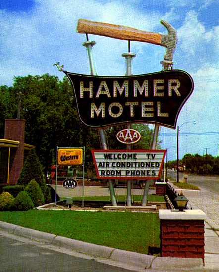
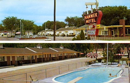
Storms also spread across Wyoming on Thursday, causing, among other damage, the roof and walls to collapse at the Moondance Diner near Green River. The 1930s factory-built diner was moved in 2007 on a trip closely paralleling the Lincoln Highway: from near the Holland Tunnel entrance in lower Manhattan, New York City, to the small town of LeBarge, Wyoming. Read more here.

Stop-action video of DeKalb to Link Wray tune

January 4, 2008

Here’s a fun video of downtown DeKalb, Illinois, assembled from thousands of still images, which are themselves a bit distorted in day-glo colors. The view races up and down Lincoln Highway at a stop-action 180 mph to the tune of “High Way” by guitar legend Link Wray (sounding like a faster version of his big hit, Rumble). It’s a jumble of imagery, but anyone familiar with DeKalb will recognize many landmarks – even if seen only for a second.

Hammer Motel, a Kearney landmark no more

January 3, 2008

The Hammer Motel on the Lincoln Highway in Kearney, Nebraska, was famous for its sign topped by a giant hammer and three supporting poles made to look like big nails. Named for the Hammer family, it served travelers for decades before being demolished in 1995 for parking.

NE_KearnHamEd
Postcards from Flickr friend Allen/Roadsidepictures.

Piecing together the story from various sources, John and Nina Hammer were married in 1935, then moved from Omaha to Kearney in 1938. John served in WWII and in 1947 they built the motel along Watson Blvd/24th St/US 30 West. A 1952 listing in the city’s Polk’s Directory also lists Fred and Belle Hammer as owners. Signs show it was a Best Western member, and matchbooks advertise that it was part of the Friendship Inn chain.

NE_KearnHam2

The family sold the motel in 1962 and it closed in 1987. The adjacent University of Nebraska at Kearney then acquired it for student housing known as Hammer Hall or Hammer Apartments or just “The Hammer.” School literature described it as “a unique living opportunity for the approximately 50 upperclass residents of this remodeled hotel facility. Each convenience-style apartment has a private entrance, living room and bathroom. A variety of room sizes, laundry and kitchen facilities, front desk services, and ‘front-door’ parking are some of the significant advantages of the facility.” But in 1995, it was razed to create additional campus parking – see blue box below for what I believe is the site.

NE_Kearney map

A 2003 newsletter article explained that the Hammers were longtime supporters of the university, and that a $27,000 gift from son Fred E. Hammer to the University of Nebraska Foundation would landscape the lot. His donation also provided for “benches, tables and columns reminiscent of the columns that marked the entrance to the old Hammer Motel” to make the parking lot “a place for students to gather.” There was also to be a plaque mounted on one of the columns commemorating the motel as a historic Kearney site. “The parking lot will still be functional,” Hammer said, “but now it will be pretty as well.”

Nothing remains of the motel except the basic shape of the site, some postcards, and the parking area now known as Lot 27.

81st Anniversary of Federal Highway Numbering

January 2, 2008

“Windy City Road Warrior” Dave Clark (author of Exploring Route 66 in Chicagoland and Route 66 in Chicago) posted an interesting story about the 81st anniversary of the federal highway numbering system. Although the highway plan was finalized in November 1926, the public announcement was delayed until January 1, 1927. Clark references a Chicago Tribune article from January 2, “U.S. Marks Ten Main Roads With Route Numbers” that explains the system that has been used ever since for federal highways: east-west route have even numbers, north-south have odd, with lowest numbers in the north and east. The 10 main transcontinental route numbers ended in 0, and the main N-S route numbers ended in 1 or 5. A tentative plan had been submitted to the American Association of State Highway Officials (AASHO) in November 1925, followed by a year of wrangling and revisions. Standardized signage was also adopted.

All this was in response to the growing tangle of named highways and their informal, inconsistent markings. It did not release funds for the highways; the focus was on standardized naming and marking, The only nod to financing upgrades was to “unimproved sections of which will be given priority in improvement,” if and when any were made.

US map
Above: A Gulf map of PA, late 1920s, shows the LH numbered as both US 30 and PA 1. The state numbers were discarded after just a few years. Seen here is from roughly Breezewood to Lancaster.

A map of the plan approved in November 1926 can be seen here. And more about the federal numbering system can be found in “From Names to Numbers: The Origins of the U.S. Numbered Highway System,” a thorough recounting by Richard F. Weingroff, Information Liaison Specialist, Federal Highway Administration.

Though named trails were not banned or eliminated, none of the multi-state ones got a single number, but rather were broken into several numbers. Named highway orgnizations could see that the plan would render their roads obsolete; the LHA grudgingly accepted the plan but asked for consideration of being designated route number 30. It got it for much of the way, originally from Philadelphia to Salt Lake City. Still, as Weingroff writes, LHA president Henry Joy

was so bitter that he wanted to send, but did not, a note to President Coolidge, his Cabinet, and all Members of Congress:

“The Lincoln Highway, a memorial to the martyred Lincoln, now known by the grace of God and the authority of the Government of the United States as Federal Route 1, Federal Route 30, Federal Route 30N, Federal Route 30S, Federal Route 530, Federal Route 40 and Federal Route 50”

The New York Times expressed similar sentiments: “The traveler may shed tears as he drives the Lincoln Highway or dream dreams as he speeds over the Jefferson Highway, but how can he get a ‘kick’ out of 46, 55 or 33 or 21?” Little did they know…!

100th Ball Drop Marks New Year in Times Square

January 1, 2008

More than a million people filled Times Square, the eastern terminus of the Lincoln Highway, to celebrate the new year with the 100th drop of a giant lit ball. An all-new version features 9,576 light-emitting diodes behind 625 triangular Waterford crystals and aluminum frame. At 11:59 pm, December 31, the ball dropped down a 77-foot pole in 60 seconds atop 1 Times Square (not to street level). Here’s a video of it being assembled:

There were also 110 certified confetti engineers who tossed out 2 tons of confetti by hand from the tops of buildings.

The ball’s LED bulbs are smaller but more than twice as bright as last year’s lights, which were a spiky mix of 600 incandescent and halogen bulbs in 4 colors. It was lit for 6 hours but used only the electricity of 10 toasters. The new lights can create more than 16 million colors (and video imagery) but were limited to 25. The $30,000 in crystal is just a small part of the ball’s $1.1 million value.

Dropping a ball has been a way to synchronize clocks since the 1800s. The first ball in Times Square was made of wood and iron and lit with 100 25-watt incandescent bulbs. It replaced a new year’s fireworks display started in 1904 that was later outlawed by city officials. Three other balls have been used since then, and now this new one, the fifth. For the next 11 month, it will rest in a vault 50 feet below 1 Times Square, beside the fourth ball.

Wyoming's Lincoln Highway Educational Series

December 31, 2007

The Wyoming State Parks and Cultural Resources has produced 20 short educational videos on the Lincoln Highway and posted them on veoh. Each one, typically a half-minute long, looks at a theme by using some facts or stories. The videos mostly use pans of still photos, many from the LHA archives. Click here for the series to start—once you do, they play consecutively, or see them all in outline form here. Here’s a screen capture of the Intro video (with a picture of the LHA’s Henry Joy and Austin Bement stuck in Nebraska):

WY_veoh

Unless I’ve missed more of the content, there is no accompanying material on veoh or on the state website to tell how best to use these or what materials were referenced, leaving a gap if they’re for education, and leaving helpful resources uncredited. For example, quotes from Thornton Round about the Rock Springs camp and the sounds while camping at night are likely culled from Gregory Franzwa’s Wyoming book. Or in discussing Navigation, they quote from what is said to be an LHA road guide, but the distinctive “Turn left around the shearing pens” material is actually from a 1913 Packard guide to the road, which is quoted in my Greetings from the Lincoln Highway book.

Here are the episodes:
1) A Brief Introduction – :37
2) What Started It – :38
3) Henry B. Joy – :16
4) The Virginian – :15
5) US Army Convoy – 1:34
6) Rock Springs – 1:07
7) Laramie – :13
8) Road Hazards – :40
9) Plains Hotel – :15
10) Mechanics – :34
11) Wyoming – :42 (though the quote is about western Nebraska)
12) Crash – :29
13) Camp – :16
14) Railroad – :45
15) Church Buttes – :24
16) Navigation – :58
17) Evanston – :23
18) Fences – :50
19) Camping – :17
20) Flat Tire – :19

Mystery Photo 4: Illinois Railroad Crossing

December 30, 2007

Here’s a sunny view of the Lincoln Highway to make us look forward to Springtime travel. It’s a railroad crossing in Illinois – can anyone identify where it’s at?

IL_MysteryPhoto4

From Calif to Mich in a 1967 British sports car

December 29, 2007

Automobile magazine copy editor Rusty Blackwell bought a 1967 MGB/GT Special through Craiglist this past fall. The challenge was getting it from San Francisco back to Ann Arbor, Michigan. His adventures with early snows and faulty fuel pumps are fun reading, even if much of it is along I-80. He does detour onto the Lincoln Highway briefly, such as Soda Springs, California; Rawlins, Wyoming; and Sidney and Gothenburg, Nebraska. He also took lots of photos. In all, his 2,300-mile trek that he hoped would take 4 days took 8. Click HERE for the first of his 9 posts. Here’s a screen shot of the opening page:

AutoMagWeb

Wal-Mart bringing change to LH south of Chicago

December 28, 2007

A story in the Southtown Star of suburban Chicago, Illinois, reports that the Lincoln Highway through New Lenox south of Chicago, will be remade over the next 18 months:

“This is the biggest news of the year. This is incredibly good news. This is the big one we have all been waiting for,” New Lenox Mayor Tim Baldermann said….

Upgrades include left-turn lanes at cross streets from Marley Road to Joliet Highway and in front of Lincoln-Way Central High School, plus temporary signals at Marley and new signals at Schoolhouse Road. [See Google Maps aerial view below.]

IL_NewLenAerial

The work, which will greatly alter the Lincoln Highway roadscape, is in preparation for a Wal-Mart plaza across from Cooper Rd/Roberts Rd/Williams St. It looks like the development will fill one of the last large pieces of land along the LH there: note the house and surrounding fields on the north side of the road.

Oddly, this is just preliminary until permanent upgrades can be done:

All work is compatible with IDOT’s ultimate $80 million plan to make Lincoln Highway a fully improved five-lane road. Money for that massive construction project is not included in any budget at this time, said New Lenox village administrator Russ Loebe.

But these interim improvements “should buy the community quite a few years of smooth cruising” on Lincoln Highway, he said.

An insightful article also was published in Chicago Business News about the real estate deal. McVickers Development bought 73.5 acres from two sellers for a combined price of $18.9 million, then will sell it to Wal-Mart, Menards home improvements, Petco, Staples, Aldi, and other retailers. McVickers will likely lose money on the sale to Wal-Mart:

Typically, an anchor tenant such as Wal-Mart demands better financial terms because the company knows the developer can make it up by charging higher rents to the smaller tenants.

“In general, developers almost never, ever make money on the big boxes, and very often they lose money,” says Matthew Silvers, a principal in the Midwest brokerage arm of Northbrook-based Next Realty LLC, who represented McVickers in the acquisition.

Mr. Silvers says major retailers like Wal-Mart dictate how much they are willing to pay for land based on their forecast of a store’s profitability.

“They’ve got their own economic analysis, and that’s just going to be what they can pay for the land, and the developers have to deal with it,” Mr. Silvers says.

1818 Chambersburg PA tollhouse donation, rehab

December 27, 2007

A 189-year-old tollhouse along the Lincoln Highway/US 30 west of Chambersburg, Pennsylvania, will be donated to the local historical society for offices and a museum. According to an article in the Chambersburg Public Opinion, the tollhouse is owned by the developer of a limestone quarry that has just won a 3-year battle to quarry 89 acres of surrounding land. St. Thomas township supervisors unanimously approved the general plan, and directed St. Thomas Development to the township planning commission, which will make a formal recommendation to the supervisors. The company plans to subdivide the land around the tollhouse and donate it the Franklin County Historical Society-Kittochtinny. Access and parking will have to be added.

PA_St. Thomas tollhouse

The small stone house just west of Campbells Run Rd was listed in the National Register of Historic Places in 1978. It served as was Tollhouse No. 2 on the Chambersburg & Bedford Turnpike (named for the its termini). Such turnpikes covered Pennsylvania in the early 1800s but fell into disrepair with the rise of canals and railroads. Bicycling, auto travel, and the Lincoln Highway revived them, though the LH worked to eliminate all tolls. Rehabbing the site also would add another tourist attraction to the 6-county Lincoln Highway Heritage Corridor.

A news staff editorial supports the developer’s plan: “The more legitimate attractions Franklin County boasts along the Heritage Corridor, the more attention it will get from the state in terms of grant money and tourism development.”