Well, not the roads but a Route 66 site and a Lincoln Highway book. Ron Warnick, whose Route 66 News was a prime inspiration for this site, just reviewed my Greetings from the Lincoln Highway, a book 10 years in the making. He was very kind in his praise – check it out or look for the Route 66 News RSS feed in the right-hand column here for regular updates of his posts.
I’m working hard to finish a follow-up book, Lincoln Highway Companion, a glove-compartment-size guide with driving maps and recommendations of places to eat, visit, and stay. And there’s LOTS out there on the Lincoln, more than any book or site could possibly capture, so don’t worry, there’s still endless surprises awaiting those who like to explore off the beaten path.
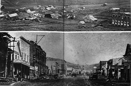
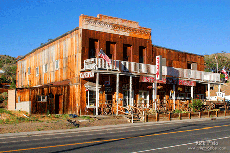
Ghost towns fascinate most of us, and many books and web sites chart the rise and fall of these once-booming settlements. Rick Pisio (see previous post) captured some amazing views at Hamilton, NV, a mining town on the original Lincoln Highway east of Ely.
Silver was discovered here in 1868, and within two years, there were more than 13,000 mining claims. Main Street grew to a mile long and the town itself a mile-and-a-half wide, with two banks, two newspapers, post office, courthouse, school system, water and steam company, churches, fire companies, and a hotel considered the state’s most expensive structure. Hamilton even became the first seat of White Pine County. But the ore layer was thin, and folks left as quickly as they had come. An intentional fire in 1873 (for insurance money) destroyed much of the town.
Even though it’s a 10-mile drive from US 50 over bumpy dirt roads, many make the journey, though their visits, and natural weathering, take a noticable toll. Online images show the brick structures crumbling a bit more every year, and soon, little will remain standing.
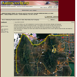
The American Road Forum is a great place to ask questions and get info from roadside experts, including, of course, for the Lincoln Highway. You can browse as a guest, but sign up so you can add your own questions and answers.
In May, Rick Pisio (whose website of impressive photos can be found in my Helpful Links section) asked about driving the LH west from the Pacific, especially the original alignment around the Great Salt Lake Desert. He got some wonderful insights and detailed replies: http://americanroadmagazine.com/forum/index.php?showtopic=383
Rick made the trip in late July with his father Matt (who turns 70 this month – happy birthday!) and 14-year-old son Richard, whom he says really enjoyed it: “I talked enough about the history of the roads we traveled and he listened in on the conversations my dad and I had during the trip enough to understand that what we were doing was not your normal vacation. I think he also realizes that opportunities for 3 generations to travel on a trip like we did do not happen that often.” Must have worked – Rick says they hope to take another trip next year.
Rick’s posts to the American Road Forum picked up his journey three days into the trip, starting at West Valley City, Utah, traveling through Skull Valley to the US Army Dugway Proving Ground: http://americanroadmagazine.com/forum/index.php?showtopic=522 Here’s a view from the start of the trip looking south on the original LH in Skull Valley:
Here’s a view looking east to the Goodyear Cutoff, a contentious shortcut that’s been off-limits for more than a half-century. The sign’s faded lettering reads “Dead End Road, No Trespassing, Government Property.” The short post on the right has the Lincoln Highway logo and “Lincoln Highway” down its length:
Days later, he captured sunset at the International Cafe in Austin, where they had the last dinner of their trip:
Anyone wanting to make the trip themselves will enjoy Rick’s storytelling and evocative images, plus maps of each day’s journey. All his posted photos, plus some not in the American Road reports, can be found at http://www.rwphotos.com/Scenics/scenicmain.htm
One of the reasons for making the trip to Gettysburg was to see the sights of Fall along the Lincoln Highway, especially produce stands. Central PA is known for its apples, peaches, cherries, and other farm products, though suburbanization is a looming threat to orchards. On the way home, we stopped to buy some pumpkins, tomatoes, apple butter, and Halloween decorations.
West of Chambersburg is Shatzer’s Fruit Market (2197 Lincoln Way West), founded 1933. Outside is one of the LHHC‘s Pump Parade decorated fiberglass pumps:
Relatives of the Shatzer family, Bingham’s Orchard and Market (9823 Lincoln Way West) farther west in St. Thomas has a larger building stocked with cider, jams, and such:
The Nebraska Division of Travel and Tourism has produced both a short and long video to promote the Lincoln Highway as a scenic route. The focus is on natural beauty and general history more than auto-era attractions, though there are some nice views of the brick road west of Omaha and Buffalo Bill’s Scouts Rest Ranch in North Platte.
The LH there is now a Nebraska Byway, not to be confused with an American Byway, the name for roads in the National Scenic Byways program, which the LH has only achieved in Illinois. The Nebraska tourism site has general descriptions of 10 such routes here.
More info and photos are available on the site for the Lincoln Highway Scenic and Historic Byway Association, “a grassroots organization that brings together businesses, government tourism entities, and individuals along Highway 30 in Nebraska to work together and promote this stretch of road to tourists.”
The only description online of the Byway program itself is in a Department of Roads brochure detailing highway sign regulations: “The Nebraska Byways Program identifies significant two-lane highways throughout the state that highlight Nebraska’s diverse topography, history, culture, recreational opportunities and landscapes.”
Here is the 29-second video. Other roads in their series get near identical narration:
The Lincoln Highway Assocation’s Indiana Chapter will hold a meeting and dinner in Plymouth on Friday, November 16 to plan the 2009 LHA national conference in South Bend, June 16-20, 2009. There are countless roles you can play, from helping with the Tin Can Tourists vintage trailer club to planning snacks to contacting sponsors to scouting tours to staffing tables.
6:30 pm – dinner at Opie’s Deli, 114 N Michigan, across from the museum. They serve sandwiches, wraps, salads, soups, etc, using many locally made products. It is in the former J.C. Penney building, renovated last year and now called the City Center.
Those needing accommodations will find a Holiday Inn Express at the intersection of US 30 and N Michigan St/old US 31, (574) 936-2444.
For more information, contact LHA Indiana Chapter President Ken Locke at <warotary@kconline.com>.
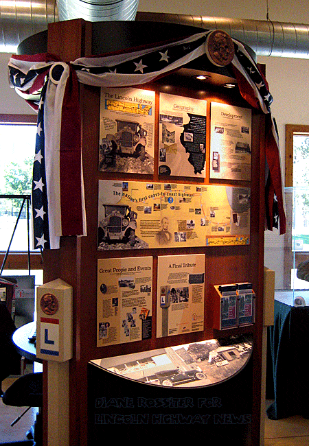
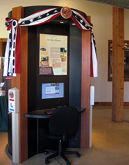
A Lincoln Highway kiosk debuted October 3 in the Phillips Park Visitor Center, 1000 Ray Moses Drive, Aurora, Illinois. The kiosk, including a computer terminal, is a project of the Illinois Lincoln Highway Coalition. An official unveiling is being planned.
Phillips Park, along Hill Avenue/Lincoln Highway just south of the city, is already known to LH fans as a former overnight auto camp opened by the Aurora Automobile Club about 1923. A brick pavilion with fireplaces was recently restored and augmented with interpretive plaques and brochures for attractions along the LH.
Coalition Associate Director Diane Rossiter (who provided the top two photos) says the 3-sided kiosk recounts the basic history of the LH and highlights a few of the state’s most interesting stories. The main feature tells the story of the Mooseheart Child City and School to the north on IL 31/LH. Moose members from across the U.S. raised $12,000 and then literally helped build the first paved section of the Lincoln Highway in front of the building. In appreciation of their efforts, the state later paved an extra 10-foot-wide section still visible in front of Mooseheart.
The computer is hooked to the coalition’s website, which has information about events and communities along the LH in Illinois. Web site visitors there or at home can also send “E-Postcards” or share a travel story to be posted online.
Other projects of the coalition include an Interpretive Center at the Dixon Welcome Center and a traveling exhibit currently at the Flagg Township Museum, 518 4th Ave, Rochelle (open Thur – Sun, 11 am – 4 pm). The exhibit will move at the start of 2008. Here it is at in July when I saw it at the Joliet Area Historical Museum:
The coalition publishes a visitor’s guide, available at the each LH town’s chamber or welcome center, at highway rest stops and info centers across the state. You can also email info@drivelincolnhighway.com or call toll free (866) 455-4249.
LHA map committee chair Paul Gilger tells us that the big story along the Lincoln Highway in California last month was the rescue of a bear hanging from the Rainbow Bridge atop Donner Summit.
According to the Tahoe Daily Tribune, the 250-pound bear climbed over the edge to avoid cars about 3 pm Saturday, Sept. 15, then got stuck and hung on overnight until being rescued around noon Sunday. Claw marks could be seen in the concrete railing where the bear tried to stop itself from falling.
A passerby got a net from an Army surplus store and strung it beneath the span, then an animal control official shot it with a tranquilizer dart. A pole was used to push the bear off the girder, then about a dozen volunteers safely lowered the bear 80 feet to the rocky ground below as about 100 spectators cheered. Truckee Animal Control Officer Dan Olsen said the joint effort included help from his organization plus The BEAR League, Nevada County Animal Control, the California Highway Patrol, and rock and tree climbers.
Photos courtesy Town of Truckee Animal Control, and special thanks to its Manager Dan Olsen.
I drove some of the Lincoln Highway’s Washington DC Feeder route on Monday. If you’ve read the LHA’s official history, you’ll know that after the route announcement in 1913, DC leaders tried to get the city on the LH, even having President Wilson plead their case, but were turned down. Impassioned LH researcher Craig Harmon kept digging to find that in 1915, LHA President Henry Joy changed his mind and put DC on the route – but only as a feeder, like at Chicago, with red-white-red signs.
The DC Feeder ran from Philadelphia south through Wilmington, DE; Baltimore, MD; DC; north to Rockville, MD; and on to Gettysburg, PA. The LHA never acknowledged it in its road guides or institutional history book.
Much of the feeder route south of Gettysburg is now US 15, or former US 15, such as through Emmitsburg, MD. South of there in Thurmont, I bought gas at the oldest station I’ve seen pumping in a long time, maybe ever. The c. 1920 station is at the corner of Emmitsburg Rd (MD 806/old LH Feeder/old US 15) and Church St. Anyone know of any older stations still operating?
Unlike most cities in PA, neither Chambersburg nor Gettysburg ever got a LH/US 30 bypass, so the route through the center of each town is often congested. You might hesitate to stop, but it’s not that hard to find a spot or get back into traffic. In Chambersburg, head a block south (109 S Main St) to grab breakfast or lunch at Molly’s. Its traditional name is the Molly Pitcher Waffle Shop, named for a Revolutionary War hero.
Theo Katsaounis cooks and sometimes delivers the food himself while Annamarie Erkson handles the work out front. They took over just eight months ago and bring some Greek flair to the menu. You’ll find traditional PA Dutch chicken with gravy over waffles, or try Anna’s Bananas Foster with a buttery rum sauce over caramelized bananas on a Belgian waffle. Omelettes are made open faced, that is, baked in a mini-casserole dish. OPEN Mon-Sat 8am-3pm.
About a block west of Gettysburg’s square is the Ragged Edge Coffeehouse (110 Chambersburg St). Open 7 years, it offers a range of coffee and teas, fruit smoothies, breakfast sandwiches, and pastries with some seating inside or on a patio.
It’s a fashionable hangout for the college crowd but draws a broad clientele. The coffee shop is next to what was built in 1916 as a lavish theater-turned-early auto garage named Eberhart’s then Epley’s, seen in vintage postcards. OPEN daily 6:30am-9pm.
Click the map above for a full-size view of the Lincoln Highway.
Like this blog? You'll LOVE my books!Lincoln Highway Companion features detailed maps and places to eat and stay. Click the book to buy it on Amazon.
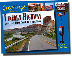
Click the Greetings book below to purchase the ultimate guide to the history and route of the Lincoln Highway!
Another fun book! The Ship Hotel: A Grand View along the Lincoln Highway recalls the greatest roadside attraction along the coast-to-coast road.
And for those who LOVE diners, click the book below to purchase our completely updated guide to the history, geography, and food of Pennsylvania's Diners!
 Well, not the roads but a Route 66 site and a Lincoln Highway book. Ron Warnick, whose Route 66 News was a prime inspiration for this site, just reviewed my Greetings from the Lincoln Highway, a book 10 years in the making. He was very kind in his praise – check it out or look for the Route 66 News RSS feed in the right-hand column here for regular updates of his posts.
 happy birthday!) and 14-year-old son Richard, whom he says really enjoyed it: “I talked enough about the history of the roads we traveled and he listened in on the conversations my dad and I had during the trip enough to understand that what we were doing was not your normal vacation. I think he also realizes that opportunities for 3 generations to travel on a trip like we did do not happen that often.” Must have worked – Rick says they hope to take another trip next year.


 The
The