Posts Tagged ‘history’

Wyoming's Lincoln Highway Educational Series

December 31, 2007

The Wyoming State Parks and Cultural Resources has produced 20 short educational videos on the Lincoln Highway and posted them on veoh. Each one, typically a half-minute long, looks at a theme by using some facts or stories. The videos mostly use pans of still photos, many from the LHA archives. Click here for the series to start—once you do, they play consecutively, or see them all in outline form here. Here’s a screen capture of the Intro video (with a picture of the LHA’s Henry Joy and Austin Bement stuck in Nebraska):

WY_veoh

Unless I’ve missed more of the content, there is no accompanying material on veoh or on the state website to tell how best to use these or what materials were referenced, leaving a gap if they’re for education, and leaving helpful resources uncredited. For example, quotes from Thornton Round about the Rock Springs camp and the sounds while camping at night are likely culled from Gregory Franzwa’s Wyoming book. Or in discussing Navigation, they quote from what is said to be an LHA road guide, but the distinctive “Turn left around the shearing pens” material is actually from a 1913 Packard guide to the road, which is quoted in my Greetings from the Lincoln Highway book.

Here are the episodes:
1) A Brief Introduction – :37
2) What Started It – :38
3) Henry B. Joy – :16
4) The Virginian – :15
5) US Army Convoy – 1:34
6) Rock Springs – 1:07
7) Laramie – :13
8) Road Hazards – :40
9) Plains Hotel – :15
10) Mechanics – :34
11) Wyoming – :42 (though the quote is about western Nebraska)
12) Crash – :29
13) Camp – :16
14) Railroad – :45
15) Church Buttes – :24
16) Navigation – :58
17) Evanston – :23
18) Fences – :50
19) Camping – :17
20) Flat Tire – :19

Sunset Motel cabins a challenge for Evanston, WY

December 18, 2007

One of the stops during the 2008 Lincoln Highway Association conference in Evanston, Wyoming, will be the remains of the Sunset Motel. The string of six rooms—three with built-in garages—are on Bear River Drive, the LH on the east end of town near WY-89. Built in 1932 in Mission or Spanish Colonial Revival style, this portion of the motel has been saved—the question now is what to do with it.

WY_Sunset1

I asked Jim Davis about the motor court. He’s Director of Administrative Services for Evanston and also on the Advisory Board for the Wyoming Main Street Program, on the Advisory Board for the National Trust for Historic Preservation, a staff member for the Evanston Historic Preservation Commission, and a founding member and past chair of Tracks Across Wyoming.

The good news about the Sunset Cabins is that they are still standing. Bad news, we still haven’t figured a new use for them and they remain threatened. The Evanston Preservation Commission had them listed as locally significant; however this does nothing to protect them as Evanston does not have a demolition ordinance or any such preservation ordinance. The cabins remain with the ownership of the city and we are still trying to figure a way for us to find adaptive reuse in order to secure their future. A little over a year ago we placed a restored Lincoln Highway marker at the site in order to draw attention as to the significance of this site.

WY_Sunset2

One of the problems with any restoration effort is how to adapt and reuse. Jane Law, City of Evanston Urban Renewal Coordinator (and who kindly arranged for these photos), says, “We have heard artist studios, concessions, but nothing that gets everyone stirred up enough to get something done…. It would truly be a shame to ever lose them, they are quite unique and really pretty cute. The state is restoring some motor cabins in Ft. Bridger, so maybe we can get some more interest there for them to come a little further west.”

Another issue is having the resources for every worthy project:

At present we really have our hands full restoring, rehabilitating, and preserving our wonderful and unique roundhouse and railyards site…. We are also trying to rehabilitate a historic hotel in our historic downtown; that has been a very long process with years of delay. Our Renewal Agency just purchased what remains of our downtown theater. That will be quite a project in itself. There was a terrible fire there in May and the building is just a shell now, but not wanting a hole in the block or a mini parking lot, we stepped up and will try to make that a viable business for our downtown. So we have our hands full, BUT the Sunset Cabins are something our Historic Preservation Commission should address. I do think those coming next year [to the LHA conference] will like them and could play a big part in thinking of a reuse. [my emphasis]

Jane also sent a detailed and fascinating hisstorical survey of the site that I’ll review soon in a separate post.

Lincoln and Dixie Highways share ties in Illinois

December 14, 2007

Dixie H banner
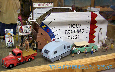
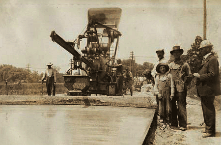
In our review of Traveling the … Historic Three by John and Lenore Weiss (which follows the Lincoln and Dixie Highways and Route 66), I mentioned Elaine E. Egdorf. Not only does she manage the Drivin’ the Dixie website, but as chairman of the Village of Homewood Heritage Committee, she got a Dixie Highway marker for Homewood, south of Chicago. The committee and the Homewood Historical Society (she was founding president) paid for the marker, which was dedicated in 2003 with a large ceremony. It was re-dedicated in 2005 as part of the kick-off for Illinois State Historical Society Markers week. The Dixie Highway communities also were recognized with a Superior Achievement Award from the ISHS for the unique way they pulled together towns, historical societies, and chambers of commerce to promote Illinois history.

The Dixie Highway was another idea of Lincoln Highway founder Carl Fisher. His north-south path was said to have been created so his wealthy auto-industry pals could more easily travel south to Fisher’s Miami Beach land developments. The Dixie was not as direct as the Lincoln, but rather a braid of roads from Sou. Ste. Marie, Michigan, to Miami, Florida. The route is now identified throughout Illinois (except Chicago) with red, white, and blue metal street signs, street pole banners, and state markers. One of at least six intersections of the Lincoln and Dixie Highways is at Chicago Heights: the roads run together for almost two miles there and their meeting is commemorated by the Arche Memorial Fountain.

IL_Dix_MkrReded05

Above: Redd Griffin, Oak Park; Elaine Egdorf, Homewood; Arthur Martin, Chicago, at the rededication in 2005. All are on the Board of Directors of the Illinois State Historical Society.

10 x 10 white square

Dixie H map

10 x 10 white square

This group’s Triangle Tour has actually evolved into Drivin’ the Dixie, a moving car show and tour from Blue Island to Momence. A passport listing events in towns along the route can be stamped at historic sites; each town donates two prizes, and for each stamp, participants get a free raffle ticket. Last year about 200 cars total participated, mostly vintage cars. It’s nice to see such support for a road that played such a big role in early auto history.

IL_Dixie car show

Fort Cody Trading Post Writes Its History

November 29, 2007

NE_FC logo
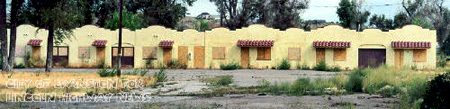
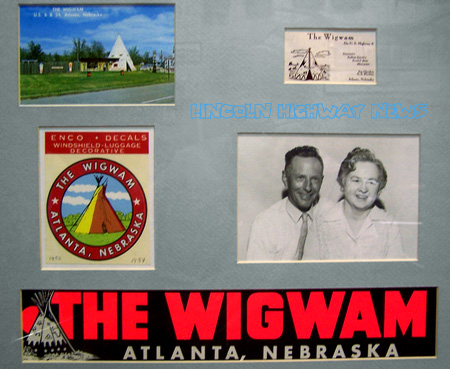
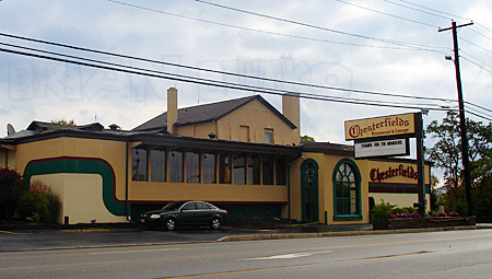
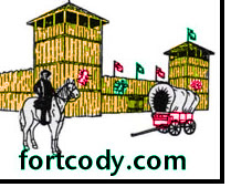
One of my favorite stops along the Lincoln Highway is Fort Cody Trading Post in North Platte, Nebraska. Since moving closer to I-80, it’s now a few blocks south of US 30 through town, though the original LH actually followed the Gothenburg Stairstep that came into town from the south on Locust (now Jeffers) Street, so Fort Cody actually overlooks the 1913 LH.

The Henline family has operated numerous businesses along the Lincoln Highway and elsewhere, so they are preparing a booklet detailing their history. Leigh Henline told me, “We are having a company make us a 24 page souvenir book to sell. We are hoping it will be ready in February. It will tell a little bit about the history of Fort Cody, a bit on the Sioux Trading Post and Buffalo Bill Trading Post. Some on the museum, LOTS on the little Buffalo Bill Wild West show (he took hundreds of photos!), and some on the Muffler Man! We are very excited about all this. This guy is also doing a bunch of photo magnets for us on the little Wild West show, due any day.”

Chuck Henline at Fort Cody
Teen-aged Chuck Henline points to the new Muffler Man Indian in the 1970s.

Here are the places the family has operated along the Lincoln Highway:
• Sioux Trading Post, Ogallala, 1952-1969.
• Buffalo Bill Trading Post, US 30 W, North Platte, 1950-1954.
• Fort Cody, US 30 W, North Platte, 1963-1969.
• Present Fort Cody, I-80 Hwy 83, North Platte, 1968 to present.

NE_FC display
Chuck Henline crafted an animated display of their Sioux Trading Post.

The family also operated the Wigwam in Atlanta, Nebraska, and the Seminole Trading Post and Indian Village near Miami. They have some photos displayed on their office walls:

NE_FC Wigwam

I’ll be writing more about their roadside adventures soon, and will post an update when their booklet is published.

Classic News Stand Closing in DeKalb, IL

November 23, 2007

Friday was the last day for a popular DeKalb intitution. A story in the DeKalb Daily Chronicle recounts the history and good times at Ralph’s News Stand & Trophy House, 664 E. Lincoln Highway. Ralph Seats owned and operated the store from 1952 until his death last year at age 83. It was popular with locals but, as the article explained, “With a small number of street parking spots near the store—and an influx of chain stores offering some, but not all, of the same services as the shop—Ralph’s is yet another signature mom-and-pop style shop to shut its doors.”

Like an old-time general store, Ralph’s carried a bit of everything: “Lock de-icer can be found next to chewing tobacco. Toward the back of the store are rows of cards offering warm praises for birthdays, graduations and other life events. Sitting among chewing gum is an old-fashioned rotary-dial phone with a detachable ear piece connected to a cord … lottery tickets, trophy engraving, Western Union service, tobacco, magazines, newspapers and a tube tester from the years when TVs needed tubes to operate.

Ralph’s first opened in the middle of the 600 block before moving to the corner of Seventh Street and Lincoln Highway. For decades it was open 5 am till midnight. Ralph insisted a big-band radio station be on at all times, which it was—until he left! His widow Doris said it’s hard to close, but “it’s a little more than I can take. It’s sad not having him here. I miss him.”

Photo Ralph’s Magazines by Joe Thorn

Gas pump at corner of Lincoln Highway and Rt 66

November 21, 2007

Ron Warnick’s Route 66 News has an interesting story about the “Joliet Kicks on 66” campaign. That Illinois city is promoting sites along the famous Chicago-to-LA road as explained in a news story. The Kicks web site offers lots of places and things to see, including 5 good-looking, very detailed replica gas pumps. Here’s a snap of the page showing the pump at the intersection of 66 and the Lincoln Highway:

IL Joliet pump
Road buffs know there’s another crossing of the two historic highways. To the west, a later alignment of 66 ran through Plainfield where 66 actually shares the road with the LH. Banners there celebrate the pairing.

Lincoln Highway fans also know that the Lincoln Highway Heritage Corridor in Pennsylvania established a fantastic Pump Parade a few years ago. Along the 200-mile corridor from Irwin to Gettysburg are 22 fiberglass replica 1940s pumps, though differing from these in that they were decorated by artists. Here’s one at Schatzer’s Market, a fruit and produce stand west of Chambersburg:

PA Shatzer’s

Roadhouse-turned-restaurant closes in W PA

November 20, 2007

Chesterfields Restaurant, a popular dining choice in North Huntingdon Twp., Pennsylvania, closed recently to make way for a Walgreens drug store and a Starbucks. The Lincoln Highway landmark just west of Irwin (now across from Norwin Shopping Center) opened as the El Dorado in 1934, then for years was the Ben Gross Supper Club, famed for its dinner theater. It had been Chesterfields since 1986, and was one of the last of the region’s legendary dinner spots. According to The Daily News [McKeesport, Oct. 23], with the current owner’s husband passed on and their two sons not interested in a labor-intensive business, they sold to Walnut Capital brokerage firm for $1.5 million. The restaurant was host to many local banquets, celebrations, and Rotary meetings, and until recently had 87 employees. Also likely to be demolished is the adjacent Kirk Haight Auto Sales, best known in years past for having a car atop a pole. See a short video of Chesterfields final day at WPXI.

PA_El Dorado
1934: Signs advertised spaghetti, steak, chicken, beer, and dancing to an orchestra.

PA_Chesterfields
2007: You can still see the roadhouse and to its left, a one-story building with gable windows.

According to a Tribune-Review article, the 3.6 acre plan needed a variance or it would not have been allowed under the shopping center code, so 58 parking spaces will serve where 87 would otherwise be required for that size development. Also, the township asked for an electronic community bulletin board along the Lincoln Highway across from the intersection with Lincoln Way (a road deceptively named in the 1920s to divert LH traffic through the Mon Valley). An Eckerd Pharmacy already sits across the road at that intersection.

According to Walnut Capital’s site, the developer also bought and is demolishing the 1964 Colonial Revival headquarters of the Municipal Authority of Westmoreland County on the Lincoln Highway to the east in Hempfield (west of Greensburg) for a Walgreens and other retail. (That 16.1 acre site went for $6 million.) In a nod to the road, it will be known as Lincoln Place. Click here for images of that development.

Vintage Photos Capture Lives on the Road

November 12, 2007

Randy Garbin recently reported on his Roadside Online about an amazing collection of roadtrip photos titled Lighting Out for the Territory. They’re on Square America, named for the common shape of old candid photos, and “dedicated to preserving and displaying vintage snapshots from the first 3/4s of the 20th Century” Collector/curator Nicholas Osborn says, “For the last eight years or so I’ve spent countless hours digging through boxes of old snapshots at flea markets (mostly here in Chicago and in NYC) and too much money buying photos on eBay. The site is my attempt to create some kind of organizational framework, however idiosyncratic, for the sprawling mess my collecting has created.” Here are two from “Lighting Out,” with his permission:

SqAm-Iowa

SqAm-Get
Above: Looking west on the Lincoln Highway east of Gettysburg, Pennsylvania, early 1970s.

And here’s his description:
“From the late 1950s through the early 1970s, Martin C. Johnson took a number of road trips criss-crossing the country from his home in Suburban Chicago to both coasts and all points in between. For each trip he put together a slide show to document his travels. Judging from these shows, he (and his wife who must be responsible for at least some of the photographs) was far more interested in the road itself than wherever his final destination might have been. For every photograph of Mount Rushmore or The Grand Canyon there were three or four shots of the empty (or not so empty) road taken through the windshield of the car. For every shot of friends and relatives visited, there were two of the motels he stayed in on the way. In doing so Johnson has left behind an invaluable record of the golden age of auto travel – an era when the new interstate highway system had opened up the country but before the development it brought had homogenized it.”

Osborn’s site is filled with countless images from about 1910-1970, grouped into categories. You might also enjoy shots from The Road:

SqAm-gas2

The images are both amazing and invaluable to roadside fans, but also a reminder that the past was not nearly as tidy as we like to remember, or recreate, it.

Indiana Curriculum to Spotlight Lincoln Highway

November 8, 2007

A Lincoln Highway curriculum unit is being prepared by the LHA Indiana chapter. “Indiana’s Historic Lincoln Highway” will offer a complete 2-week course for grades 3 and 4, formatted to Indiana State Standards. Project Leader Joyce Chambers says a team has been working for a year and a half gathering information and creating hands-on activities for topics such as maps, math, art, music, language, and science. Field research is wrapping up for this year as colder weather approaches.

IN_UM concrete
Above: Pouring the last concrete between Osceola and Mishawaka, Indiana. (Univ of Michigan, Special Collections Library, lhc2276)

The kit will likely contain a Teacher’s Guide, Student Booklet, DVD history of the road, possibly some model race cars (a nod to Carl Fisher’s connection to the Indy Speedway), a LH BINGO Game, and images of the road in Indiana, all in a sturdy tote bag. Sections may include Overview, Construction, Bridges, Tollhouses & Mile Markers, Travelers, Accommodations, Workers along the Road, Fun Sheets, Timeline, Lincoln Highway Sites, Glossary, Bibliography, Evaluation, and information on the LHA. The South Bend Community School Corporation’s Print Shop will donate the printing.

IN_UM_Ideal Sec 
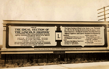
Above: A billboard on the Lincoln Highway’s famous Ideal Section in western indiana, 1927. (Univ of Michigan, Special Collections Library, lhc2793)

Three or four schools will test a pilot version for the 2008-’09 school year, then it will be evaluated and revised for release in 2009-’10 to public libraries and schools along the LH. Further suggestions will be incorporated into a final version available to all Indiana schools, including homeschoolers and private/parochial. It will be available through “check out” at the Center for History Education Department, where other such kits are stored for teachers. A similar highway-themed curriculum is Traveling the National Road Classroom Activity Program.

A kit and PowerPoint show will be presented at the LHA’s 2008 conference, and a presentation at the ’09 event will include feedback from the test year. It sounds like a solid plan, and a model program for other LH states.

IN_UM_curve
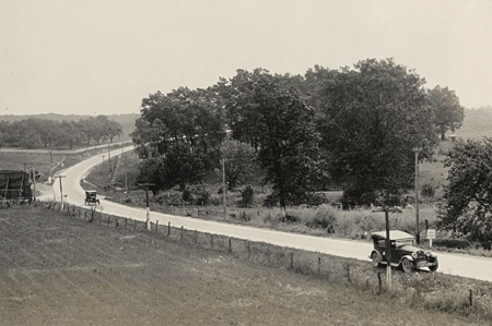
Above: The LHA Packard touring through Indiana, 1925. (Univ of Michigan, Special Collections Library, lhc2313)

For more information, or to make suggestions about content, contact Joyce Chambers at joycechambers47@aol.com (574) 272-5374.