Posts Tagged ‘Route 66’

Model Ts 100 years old and touring coast-to-coast

May 9, 2008

Above, The 10 Millionth Ford (with Lincoln Highway markings) arrives at San Francisco, California, 1924. Drive Frank Kulick is handing Mayor J. Rolph a letter from Mayor Hylan of New York City. Courtesy University of Michigan, Special Collections Library, lhc3000.

A transcontinental tour of Ford Model Ts was launched on May 5 in honor of the car’s centennial. The “Sea to Sea by T” tour is traveling from Baltimore to Los Angeles via Route 40 and Route 66, missing the Lincoln Highway but nonetheless of note to old car and highway enthusiasts. The cars were shipped to Baltimore last month and the participants flew in May 3rd to start the tour. A sampling of overnight stops includes Springfield MO on May 13; Amarillo TX on May 17; Albuquerque NM on May 21; Williams AZ on May 24-25; and arrive LA on May 28. Details are scarce; the national Model T Club recommends contacting the Model T Ford Club of Southern California c/o Lee Chase (323) 938-4601, though most of what they know is reported here.

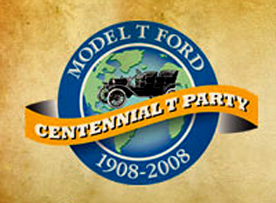
Also note that the Model T Ford Club of America and Ford Motor Company will honor the 100 year birthday of the Model T with an official celebration July 21-26, 2008 at the Wayne County Fairgrounds (861 Salisbury Road N) in Richmond, Indiana, which is 60 miles east of Indianapolis & 35 miles west of Dayton, Ohio. Click the logo above for more info.

Henry Ford chose not to align with the Lincoln Highway Association or any road that depended on private funding, but his son Edsel supported their efforts, most famously with a tour of the 10 Millionth Model T along the Lincoln Highway in 1924.

Wallis to talk of Lincoln Highway at Univ Missouri

May 2, 2008

Author Michael Wallis will talk about the Lincoln Highway on May 9 at 3:30 p.m. in the Elmer Ellis Auditorium at the University of Missouri. Wallis is author of The Lincoln Highway: Coast to Coast from Times Square to the Golden Gate along with Route 66: The Mother Road. An MU alumnus, Wallis has previously donated several first editions of his books to the university library.

RSVP is preferred; contact Sheila Voss at vosss@missouri.edu or at (573) 882-9168.

81st Anniversary of Federal Highway Numbering

January 2, 2008

“Windy City Road Warrior” Dave Clark (author of Exploring Route 66 in Chicagoland and Route 66 in Chicago) posted an interesting story about the 81st anniversary of the federal highway numbering system. Although the highway plan was finalized in November 1926, the public announcement was delayed until January 1, 1927. Clark references a Chicago Tribune article from January 2, “U.S. Marks Ten Main Roads With Route Numbers” that explains the system that has been used ever since for federal highways: east-west route have even numbers, north-south have odd, with lowest numbers in the north and east. The 10 main transcontinental route numbers ended in 0, and the main N-S route numbers ended in 1 or 5. A tentative plan had been submitted to the American Association of State Highway Officials (AASHO) in November 1925, followed by a year of wrangling and revisions. Standardized signage was also adopted.

All this was in response to the growing tangle of named highways and their informal, inconsistent markings. It did not release funds for the highways; the focus was on standardized naming and marking, The only nod to financing upgrades was to “unimproved sections of which will be given priority in improvement,” if and when any were made.

US map
Above: A Gulf map of PA, late 1920s, shows the LH numbered as both US 30 and PA 1. The state numbers were discarded after just a few years. Seen here is from roughly Breezewood to Lancaster.

A map of the plan approved in November 1926 can be seen here. And more about the federal numbering system can be found in “From Names to Numbers: The Origins of the U.S. Numbered Highway System,” a thorough recounting by Richard F. Weingroff, Information Liaison Specialist, Federal Highway Administration.

Though named trails were not banned or eliminated, none of the multi-state ones got a single number, but rather were broken into several numbers. Named highway orgnizations could see that the plan would render their roads obsolete; the LHA grudgingly accepted the plan but asked for consideration of being designated route number 30. It got it for much of the way, originally from Philadelphia to Salt Lake City. Still, as Weingroff writes, LHA president Henry Joy

was so bitter that he wanted to send, but did not, a note to President Coolidge, his Cabinet, and all Members of Congress:

“The Lincoln Highway, a memorial to the martyred Lincoln, now known by the grace of God and the authority of the Government of the United States as Federal Route 1, Federal Route 30, Federal Route 30N, Federal Route 30S, Federal Route 530, Federal Route 40 and Federal Route 50”

The New York Times expressed similar sentiments: “The traveler may shed tears as he drives the Lincoln Highway or dream dreams as he speeds over the Jefferson Highway, but how can he get a ‘kick’ out of 46, 55 or 33 or 21?” Little did they know…!

Weiss Duo Cover Triangle of Historic Highways

November 27, 2007

John and Lenore Weiss are well-known to Route 66 fans for the work they’ve done to help preserve, promote, and document that road, especially in Illinois. Lincoln Highway fans are starting to hear about them too, most noticeably leading the acquisition from IDOT of a 1928 concrete LH post, then John served as Master of Ceremonies at its dedication on Veterans Day 2006 at the Joliet Historical Museum. Their newest project merges 66, the LH, and even the Dixie Highway.

Weiss Book

Traveling the … Historic Three is a 74-page spiral-bound guide to traveling those three highways in a 110-mile, triangle-shaped route south of Chicago. John and Lenore freely give credit to the conceptual idea of combining these three roads into one road trip to Elaine Egdorf who administers Drivin’ the Dixie, a web site devoted to that road. The booklet has an intro, then tabs divide each section, and there’s a page of related organizations at the end. Narration is casual in the way a good friend would lead you on a tour, with instructions for when to turn, what to see, where to park, and recommended places to eat and visit. Lincoln Highway fans will be pleased to discover much that they may not have noticed until slowed down to a tour on the local level.

Lenore told me a little bit about their work:

The unique aspect of the triangular tour is that you can start at any of three locations and end up exactly where you started! With any road trips, folks travel say 100 miles, then they must return. This results in an extra 100 miles.

In this area, the Lincoln Highway and especially the Dixie Highway communities and businesses are not very accustomed to tourism. This is an interesting aspect when compared to those on Route 66. On the Lincoln, the town of Frankfort wants to get involved. On the Dixie, the town of Homewood is equally as excited.

Since we already had the Route 66 portion, and have lived on that particular section of the Lincoln Highway for 30 years, only the Dixie needed some real investigation. And that, too, was a rewarding experience.

And she notes that every time they drive it, as recently as last week, they keep discovering new things.

Weisses
Above: John and Lenore Weiss with Route 66 tattoo man Jim Bush in the souvenir-filled gift shop at the Joliet Area Historical Museum, a must-stop for road fans.

Highlights at the intersections include the Art Institute of Chicago at Jackson Avenue and Columbus Drive in Chicago, where 66 and the Dixie launch; the Joliet Area Historical Museum where 66 and the LH meet, at Cass and Ottawa streets in Joliet; and the Arche Memorial Fountain where the LH and Dixie meet, built 1916 as part of a rest park for travelers of the two roads in Chicago Heights. As you can see, the three roads offer lots to see for fans of old roads. This and other books by the Weisses are available at gift shops such as the Joliet Museum or through the couple’s web site. An autographed copy of Traveling the … Historic Three is $9.95 + $4.60 postage and handling.

Gas pump at corner of Lincoln Highway and Rt 66

November 21, 2007

Ron Warnick’s Route 66 News has an interesting story about the “Joliet Kicks on 66” campaign. That Illinois city is promoting sites along the famous Chicago-to-LA road as explained in a news story. The Kicks web site offers lots of places and things to see, including 5 good-looking, very detailed replica gas pumps. Here’s a snap of the page showing the pump at the intersection of 66 and the Lincoln Highway:

IL Joliet pump
Road buffs know there’s another crossing of the two historic highways. To the west, a later alignment of 66 ran through Plainfield where 66 actually shares the road with the LH. Banners there celebrate the pairing.

Lincoln Highway fans also know that the Lincoln Highway Heritage Corridor in Pennsylvania established a fantastic Pump Parade a few years ago. Along the 200-mile corridor from Irwin to Gettysburg are 22 fiberglass replica 1940s pumps, though differing from these in that they were decorated by artists. Here’s one at Schatzer’s Market, a fruit and produce stand west of Chambersburg:

PA Shatzer’s

LH Roadside Attractions among Priceless Picks

November 11, 2007

I was asked by MasterCard to be part of their online Priceless Picks campaign. There are lots of interesting places in people’s picks; I chose roadside attractions and of course included some Lincoln Highway sites. Here’s a link to mine, where you’ll find LH mentions of the fun Shoe House in Hallam, Pennsylvania, and souvenir-filled Fort Cody Trading Post in Nebraska. There’s also a photo to click of Peppi’s Diner on the LH in Wilkinsburg, Pennsylvania. Other picks include Wigwam Village motel on Route 66 in Holbrook, Arizona; the crazy Mexican restaurant Casa Bonita in Denver; dinos battling Civil War soldiers at Dinosaur Kingdom in Natural Bridge, Virginia; and the 1950s-era Eddie’s Grill in little Geneva-on-the-Lake, Ohio.

Priceless Picks

Click the Lincoln Highway Map

November 7, 2007

For those not familiar with the route of the Lincoln Highway, I now have a map available based on the one in my Greetings book. Click the thumbnail below or the really tiny one to the right and you’ll get a US map up to 19 inches wide, just like this one:

Butko Greetings LH map - Med

The first generation represents the “Proclamation Route” of 1913. Towns like Trenton, NJ; Marion, OH; and Ogden, UT were quickly removed (though Ogden would later be put back on).

You’ll also see the Colorado Loop, which the LHA soon regretted but nonetheless approved of for two years. Note also that there were two ways around Lake Tahoe in eastern California. West of Sacramento, the 1928 rerouting is being debated of late as to whether the change was officially endorsed by the LHA board. It’s included because that’s where the LHA’s concrete posts went in 1928.

The first tally of the Lincoln Highway’s length was 3,389 miles (including Camden and Marion but not Ogden), though it would always be in flux due to bypasses and realignments. More than a decade later, the now more-famous US Route 66 would run 2,448 miles from Chicago to Los Angeles (though it likewise would vary in length).

Route 66 Reviews the Lincoln Highway

November 5, 2007

Greetings cover 2
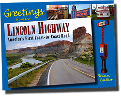
Well, not the roads but a Route 66 site and a Lincoln Highway book. Ron Warnick, whose Route 66 News was a prime inspiration for this site, just reviewed my Greetings from the Lincoln Highway, a book 10 years in the making. He was very kind in his praise – check it out or look for the Route 66 News RSS feed in the right-hand column here for regular updates of his posts.

I’m working hard to finish a follow-up book, Lincoln Highway Companion, a glove-compartment-size guide with driving maps and recommendations of places to eat, visit, and stay. And there’s LOTS out there on the Lincoln, more than any book or site could possibly capture, so don’t worry, there’s still endless surprises awaiting those who like to explore off the beaten path.